Wells National Estuarine Research Reserve

Results: 95


#Item
11Mackay Coasts and Communities  Sandfly Creek Environmental Reserve Management Plan

Mackay Coasts and Communities Sandfly Creek Environmental Reserve Management Plan

Add to Reading List

Source URL: reefcatchments.com.au

Language: English - Date: 2013-02-20 02:51:06
12Cartography / Science / Geography / Collaborative mapping / Human geography / Esri / Indian Institute of Remote Sensing / Geographic information systems / ArcView 3.x / Wells National Estuarine Research Reserve

Susan Bickford  GIS/Natural Resource Specialist  .8 FTE 2015 Susan Bickford has been the GIS/Natural Resource Specialist for the Wells National Estuarine Research Reserve in Wells, Maine since May of[removed]He

Add to Reading List

Source URL: www.wellsreserve.org

Language: English - Date: 2015-01-05 09:17:48
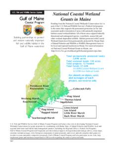
13U.S. Fish and Wildlife Service Update  Gulf of Maine Coastal PProgram rogram

U.S. Fish and Wildlife Service Update Gulf of Maine Coastal PProgram rogram

Add to Reading List

Source URL: www.fws.gov

Language: English - Date: 2011-03-31 13:44:58
14Laudholm Trust FY2015-2019 Strategic Plan Approved by the Laudholm Trust Board of Trustees November 4, 2014 Table of Contents About the Wells National Estuarine Research Reserve and Laudholm Trust .......................

Laudholm Trust FY2015-2019 Strategic Plan Approved by the Laudholm Trust Board of Trustees November 4, 2014 Table of Contents About the Wells National Estuarine Research Reserve and Laudholm Trust .......................

Add to Reading List

Source URL: www.wellsreserve.org

Language: English - Date: 2014-11-25 15:16:24
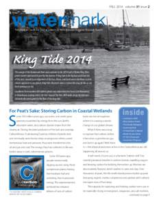
15watermark  FALL 2014 volume 31 issue 2 Published by Laudholm Trust in support of Wells National Estuarine Research Reserve

watermark FALL 2014 volume 31 issue 2 Published by Laudholm Trust in support of Wells National Estuarine Research Reserve

Add to Reading List

Source URL: www.wellsreserve.org

Language: English - Date: 2014-12-02 08:26:51
16FOR IMMEDIATE RELEASE  PICTURING THE FUTURE OF OUR COAST Gulf of Maine King Tides Photo Contest Planned for October 9 WELLS, Maine, September 26, 2014 — Along the 7,500-mile Gulf of Maine shoreline, an extreme high tid

FOR IMMEDIATE RELEASE PICTURING THE FUTURE OF OUR COAST Gulf of Maine King Tides Photo Contest Planned for October 9 WELLS, Maine, September 26, 2014 — Along the 7,500-mile Gulf of Maine shoreline, an extreme high tid

Add to Reading List

Source URL: www.wellsreserve.org

Language: English - Date: 2014-09-26 16:14:06
17Steve Maslowski/USFWS  Bibliography Wood thrush

Steve Maslowski/USFWS Bibliography Wood thrush

Add to Reading List

Source URL: www.fws.gov

Language: English - Date: 2007-07-18 12:32:47
18NOAA’s Office of Ocean & Coastal Resource Management[removed]CELCP Projects Dabob Bay Natural Area Acquisition, Washington The Washington Department of Ecology and Department of Natural Resources will protect a total of

NOAA’s Office of Ocean & Coastal Resource Management[removed]CELCP Projects Dabob Bay Natural Area Acquisition, Washington The Washington Department of Ecology and Department of Natural Resources will protect a total of

Add to Reading List

Source URL: www.coast.noaa.gov

Language: English - Date: 2014-11-21 13:56:54
19Edward Henry/USFWS  Chapter 3 Description of the Affected Environment 

Edward Henry/USFWS Chapter 3 Description of the Affected Environment 

Add to Reading List

Source URL: www.fws.gov

Language: English - Date: 2006-08-17 09:50:35
20wellsreserve at laudholm Communicating about Climate Impacts TheMoody Sandy

wellsreserve at laudholm Communicating about Climate Impacts TheMoody Sandy

Add to Reading List

Source URL: www.wellsreserve.org

Language: English - Date: 2014-08-26 09:38:23